Brazil is divided in the North, Northeast, South, Southeast and Midwest regions; the United States consist of the Northeast, South, West, Midwest and Pacific States (Alaska and Hawaii). Both the USA and Brazil are federal republics made up of states (not provinces), and both nations’ flags feature stars on a blue background representing the states of the federation, with the number of stars on both flags increasing as new states emerged.
In Brazil, the North is also sometimes erroneously called the Amazon, since it encompasses the whole of the North, part of the Midwest and the Northeast, spreading out of the Brazilian territory, as well as in the USA, the Northeast is also sometimes wrongly called New England, as this is strictly only part of the American Northeast.
Southern Brazil is a highly developed region, with great presence of foreign immigrants, whereas the Northeast, dominated by large landowners, is the least developed region and with the strongest cultural identity. Conversely, the North-Eastern United States is the most developed region, with large numbers of foreign immigrants, while the South, of slavery and racist tradition, is the least developed region and with the strongest cultural identity (especially after the Civil War). Both the South of the United States and the Northeast of Brazil are the regions with the highest numbers of blacks in their respective countries. If the Brazilian Northeast has always been dominated by landowners, the American South is dominated by oil producing farmers (an example of the American version of landowner domination can be seen in the old TV series Dallas). And if the American South witnessed the Hatfield and McCoy families’ war in the 19th century, the Brazilian Northeast witnessed the war between the Oliveira and Suassuna families in the 20th century.
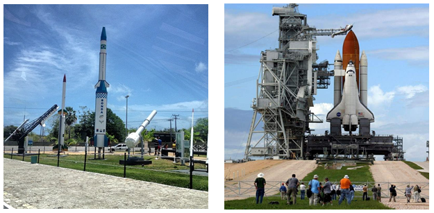
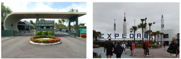
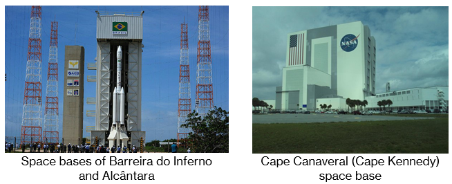
The Brazilian Northeast and the US South are also the hottest regions and concentrating the most beautiful beaches of both countries. And it is at the eastern end of these two regions that the rocket launch bases of the two countries are located: Barreira do Inferno, in Parnamirim, state of Rio Grande do Norte, and Cape Canaveral (or Kennedy), in Merritt Island, Florida. It should also be mentioned that, both in the USA and in Brazil, colonisation began in the Northeast.
A curiosity: it is in the Northeast region of both Brazil and the USA that the two smallest states of each federation are located: Sergipe and Alagoas (Brazil) and Rhode Island and Delaware (USA), all of them very small in relation to the others. On the other hand, the largest Brazilian state, Amazonas, is in the North region, as well as the largest American state, Alaska, is also located in the north. And it is in these two states that the highest points of the two countries are located: Pico da Neblina, whose Indian name (Yanomami) is Yaripo, located in the Imeri Range, in the Pico da Neblina National Park; and Mount McKinley, called Denali by the Koyukon Indians, located in the Alaska Range, in the Denali National Park and Preserve.
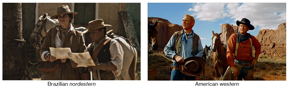
Speaking once more of the Northeast, a typical figure from this region of Brazil is the cangaceiro, an outlaw of the early 20th century who became the subject of literature and cinema, giving rise to the “nordestern” genre, an imitation of the American western. (“Nordestern” is a merger of the Portuguese word nordeste ‘Northeast’ and the suffix ‑ern of western.)
Another fact that stands out is that Brazil and the USA have some states whose acronyms are identical: AL (Alagoas/Alabama), MA (Maranhão/Massachusetts), MS (Mato Grosso do Sul/Mississippi), MT (Mato Grosso/Montana), PA (Pará/Pennsylvania), PR (Paraná/Puerto Rico), SC (Santa Catarina/South Carolina). And there is still some graphic similarity between Santa Catarina and South Carolina, as well as between Amazonas and Arizona.

The Brazilian and the American Midwest, both of similar physical geography (plains and savannas), are regions of intermediate development, with strength in farming.
The largest Brazilian state, Amazonas (North Region), is dominated by the Amazon rainforest, while the largest US state, Alaska (north to the USA), is dominated by ice. For this reason, both states have the lowest demographic densities in their respective countries.
Among the countries of continental extension (Russia, Canada, China, USA, Brazil and Australia), virtually only Brazil and the USA have states of the same name that differ by adding a cardinal point.[1] Thus we have in Brazil Rio Grande do Norte and Rio Grande do Sul, Mato Grosso and Mato Grosso do Sul; in the USA, we have North Carolina and South Carolina, North Dakota and South Dakota, Virginia and West Virginia.
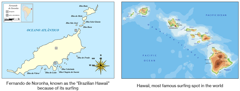
In addition, both Brazil and the USA had federal territories that were promoted to the status of states: in Brazil, Acre, Rondônia, Roraima and Amapá; in the USA, Alaska and Hawaii. The latter is an archipelago in the Pacific Ocean; in Brazil, the archipelago of Fernando de Noronha, in the Atlantic Ocean, was also previously a territory, with the difference that it was not elevated to the condition of state but annexed to the state of Pernambuco.
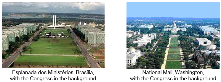
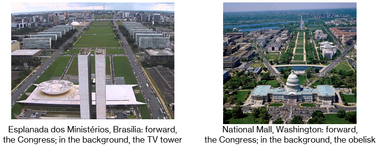
Neither Washington, DC, nor Brasília–DF, the federal capitals, are the largest cities of their respective countries, although they are among the most populous. And both cities were designed to be capitals. The American capital was designed by Pierre L’Enfant, and the Brazilian one by Lúcio Costa and Oscar Niemeyer. Both cities are coextensive with the respective federal districts, and in both cases, although it consists of a single administrative unit, these districts encompass several small cities around the capitals.
São Paulo (the “Drizzle Land” or “the city that never stops”) rivals New York (the “Big Apple” or “the city that never sleeps”) as the financial, gastronomy and fashion capital, as well as being the two most populous and important cities of their respective countries — and have a lot in common, such as massive presence of immigrants, which characterise certain neighbourhoods, like Italians in Bexiga and Little Italy or Asians in Liberdade and Chinatown. In fact, both São Paulo and New York have neighbourhoods whose accent is typically influenced by Italian immigrants. These are Mooca, in São Paulo, and Brooklyn, in New York.
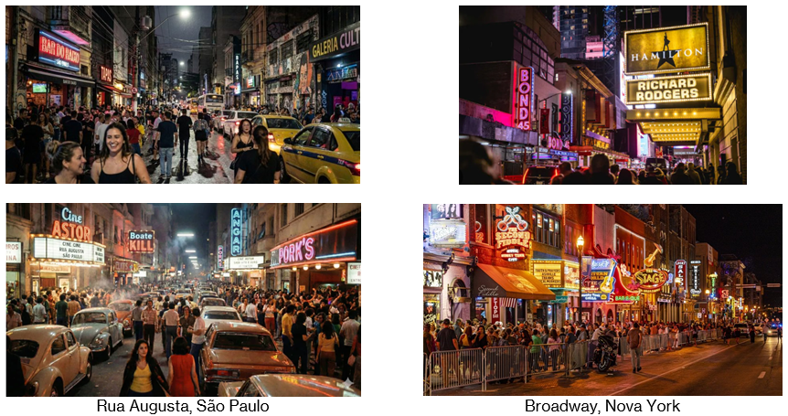
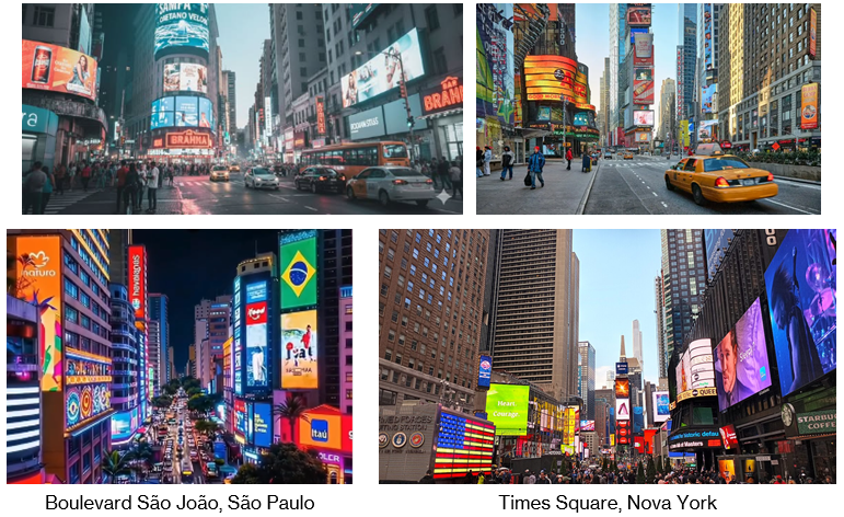
New York and São Paulo also have each their “theatre street”: Broadway and Augusta. And also their famous corner: Seventh Avenue with Broadway (that is, Times Square, the most famous corner in the United States — and the world) and Ipiranga Avenue with São João Avenue (Boulevard São João, the most famous corner of Brazil and the South Hemisphere).
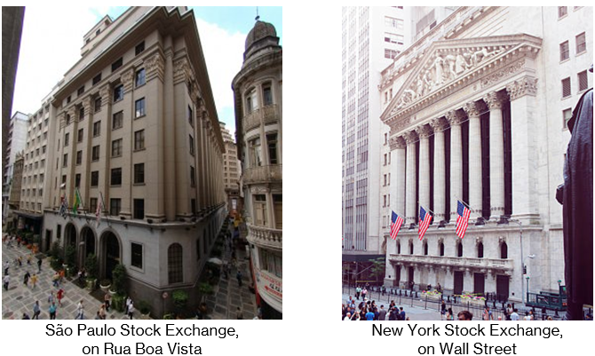
São Paulo has had its “crackland” (an outdoor drug market), around Helvetia Street, downtown; New York has had one, at Bryant Park, Manhattan. New York is home to the New York Stock Exchange (NYSE), the largest stock exchange in the world, while São Paulo is home to the São Paulo Stock Exchange (Bovespa, currently B3), the most important in Latin America and the Southern Hemisphere, so that their addresses (Wall Street and Rua Boa Vista) became synonymous with economic power.
In 2020, during the COVID-19 pandemic, the USA and Brazil were the two countries with the highest number of cases of the disease and deaths, and New York and São Paulo were the two most affected cities in the world. In early 2021, Rio de Janeiro overtook São Paulo in number of deaths from the disease, at the same time California overtook New York.

Finally, both are cut through by important rivers (Hudson and Tietê).
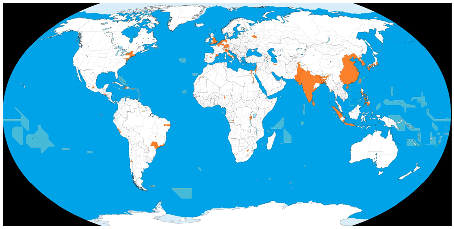
Now look at the map below. It shows the regions that, together, reunite half of the planet’s population. As can be seen, this human contingent is mainly concentrated in the East (especially India, China and Indonesia), in Western Europe (especially the countries that I call “central” here: France, the United Kingdom, Italy and Germany) and around the states of São Paulo and New York: we have a conurbation connecting the states of São Paulo and Rio de Janeiro and another that goes from New York to Washington — the so-called “megalopolis”.
__________
[1] Mexico, which has the states of Baja California and Baja California Sur, is not among the countries with large territorial extension; Australia has New South Wales (but there is no New North Wales). Moreover, in all other respects, neither Mexico nor Australia have symmetries with Brazil or the United States.